Accotink Creek Fishing Spot
- County: Fairfax
- Public Fishing: Yes
- Last Modified By: standsinacreek on 08/19/08 05:53 PM
- Ask about Accotink Creek in our Fishing Forums
Photos
Fish Species
Comments
-
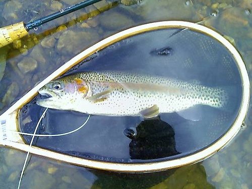
This is urban trout fishing in every sense of the word. Part of this creek is right beside the Washingotn 495 beltway. Accotink is a Delayed Harvest Creek, which is small at best. The pressure is very heavy, and Poaching is a problem. Your lucky to get a fish in June when the delayed harvest is open. When I fish here, which isnt that often, I take a walking stick with me that doubles as a defense measure, just in case.
Accotink Creek Baits and Tackle
Crankbait Check Prices
Blade Bait Check Prices
Spinnerbait / Buzzbait Check Prices
- A worm with a 4"-6" tail works good during the afternoon. When the sun hits the tree line throw a buzzbait.
Jigging Spoon Check Prices
Craw Check Prices
- Used rubber grayfish, grubs, as well as crank baits.
Nightcrawler Check Prices
Accotink Creek Description
The Northern most end of Accotink Creek above Accotink Lake is Delayed Harvest water
Accotink Creek is a tidal tributary stream of the Potomac River in Fairfax County, Virginia. At Springfield, Accotink Creek is dammed to create Lake Accotink. The stream empties into the Potomac at Gunston Cove's Accotink Bay to the west of Fort Belvoir.